Ordnance gazetteer of Scotland
(1265) Page 1257
Download files
Complete book:
Individual page:
Thumbnail gallery: Grid view | List view

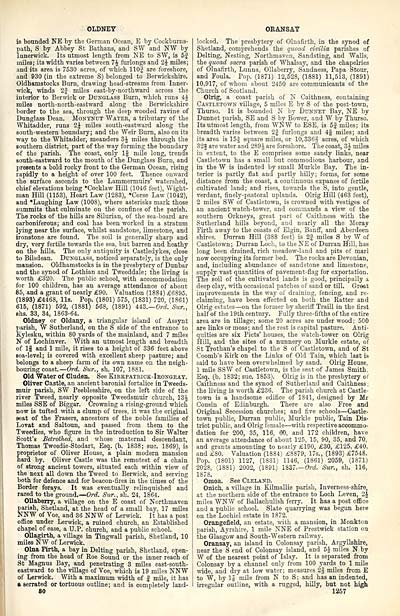
OLDNEY
is bounded NE by the German Ocean, E by Cockburns-
path, S by Abbey St Bathans, and SW and NW by
Innerwiek. Its utmost length from NE to SW, is 5f
miles; its width varies between 7 J furlongs and 2$ miles;
and its area is 7530 acres, of which 110J are foreshore,
and 930 (in the extreme S) belonged to Berwickshire.
Oldhamstocks Burn, drawing head-streams from Inner-
wick, winds 2f miles east-by-northward across the
interior to Berwick or Dunglass Burn, which runs 4i
miles north-north-eastward along the Berwickshire
border to the sea, through the deep wooded ravine of
Dunglass Dean. Monynut Water, a tributary of the
Whitadder, runs 2J miles south-eastward along the
south-western boundary; and the Weir Burn, also on its
way to the Whitadder, meanders 3J miles through the
southern district, part of the way forming the boundary
of the parish. The coast, only 1§ mile long, trends
south-eastward to the mouth of the Dunglass Burn, and
presents a bold rocky front to the German Ocean, rising
rapidly to a height of over 100 feet. Thence onward
the surface ascends to the Lammermuirs' watershed,
chief elevations being "Cocklaw Hill (1046 feet), Wight-
man Hill (1153), Heart Law (1283), "Corse Law (1042),
and "Laughing Law (100S), where asterisks mark those
summits that culminate on the confines of the parish.
The rocks of the hills are Silurian, of the sea-board are
carboniferous; and coal has been worked in a stratum
lying near the surface, whilst sandstone, limestone, and
ironstone are found. The soil is generally sharp and
dry, very fertile towards the sea, but barren and heathy
on the hills. The only antiquity is Castledykes, close
to Bilsdean. Dunglass, noticed separately, is the only
mansion. Oldhamstocks is in the presbytery of Dunbar
and the synod of Lothian and Tweeddale; the living is
worth £320. The public school, with accommodation
for 100 children, has an average attendance of about
85, and a grant of nearly £90. Valuation (1884) £6895.
(1893) £4468, lis. Pop. (1801) 575, (1831) 720, (1861)
615, (1871) 592, (1881) 568, (1891) UZ.—Ord. Stir.,
shs. 33, 34, 1863-64.
Oldney or Oldany, a triangular island of Assynt
parish, W Sutherland, on the S side of the entrance to
Kylesku, within 80 yards of the mainland, and 7 miles
N of Lochinver. With an utmost length and breadth
of If and 1 mile, it rises to a height of 336 feet above
sea-level; is covered with excellent sheep pasture; and
belongs to a sheep farm of its own name on the neigh-
bouring coast. — Ord. Sur., sh. 107, 1881.
Old Water of Cluden, See Kiekpatrick-Ibongeay.
Oliver Castle, an ancient baronial fortalice in Tweeds-
muir parish, SW Peeblesshire, on the left side of the
river Tweed, nearly opposite Tweedsmuir church, 13J
miles SSE of Biggar. Crowning a rising-ground which
now is tufted with a clump of trees, it was the original
seat of the Frasers, ancestors of the noble families of
Lovat and Saltoun, and passed from them to the
Tweedies, who figure in the introduction to Sir Walter
Scott's Betrothed, and whose maternal descendant,
Thomas Tweedie-Stodart, Esq. (b. 1838; sue. 1869), is
proprietor of Oliver House, a plain modern mansion
hard by. Oliver Castle was the remotest of a chain
of strong ancient towers, situated each within view of
the next all down the Tweed to Berwick, and serving
both for defence and for beacon-fires in the times of the
Border forays. It was eventually relinquished and
razed to the ground.— Ord Sur., sh. 24, 1864.
Ollaberry, a village on the E coast of Northmaven
parish, Shetland, at the head of a small bay. 17 miles
NNW of Voe, and 36 NNW of Lerwick. It has a post
office under Lerwick, a ruined church, an Established
chapel of ease, a U.P. church, and a public school.
Ollagirth, a village in Tingwall parish, Shetland, 10
miles NW of Lerwick.
Olna Firth, a bay in Delting parish, Shetland, open-
ing from the head of Roe Sound or the inner reach of
St Magnus Bay, and penetrating 3 miles east-south-
eastward to the village of Voe, which is 19 miles NNW
of Lerwick. With a maximum width of | mile, it has
» serrated or tortuous outline ; and is completely land-
80
ORANSAY
locked. The presbytery of Olnafirth, in the synod of
Shetland, comprehends the quoad civilia parishes of
Delting, Nesting, Northmaven, Sandsting, and Walls,
the quoad sacra parish of Whalsay, and the chapelries
of Olnafirth, Lunna, Ollaberry, Sandness, Papa Stour,
and Foula. Pop. (1871) 12,528, (1881) 11,513, (1891)
10,917, of whom about 2450 are communicants of the
Church of Scotland.
Olrig, a coast parish of N Caithness, containing
Castletown village, 5 miles E by S of the post-town,
Thurso. It is bounded N by Dunnet Bay, NE by
Dunnet parish, SE and S by Bower, and W by Thurso.
Its utmost length, from WNW to ESE, is 5 j miles; its
breadth varies between 2| furlongs and 4§ miles; and
its area is 15J square miles, or 10,3363 acres, of which
32f are water and 289 J are foreshore. The coast, 3J miles
in extent, to the E comprises some sandy links, near
Castletown has a small but commodious harbour, and
in the W is indented by small Murkle Bay. The in-
terior is partly flat and partly hilly; forms, for some
distance from the coast, a continuous expanse of fertile
cultivated land; and rises, towards the S, into gentle,
verdant, finely-pastoral uplands. Olrig Hill (463 feet),
2 miles SW of Castletown, is crowned with vestiges of
an ancient watch-tower, and commands a view of the
southern Orkneys, great part of Caithness with the
Sutherland hills beyond, and nearly all the Moray
Firth away to the coasts of Elgin, Banff, and Aberdeen
shires. Durran Hill (388 feet) is 2| miles S by W of
Castletown; Durran Loch, to the NE of Durran Hill, has
long been drained, rich meadow-land and pits of marl
now occupying its former bed. The rocks are Devonian,
and, including abundance of sandstone and limestone,
supply vast quantities of pavement-flag for exportation.
The soil of the cultivated lands is good, principally a
deep clay, with occasional patches of sand or till. Great
improvements in the way of draining, fencing, and re-
claiming, have been effected on both the Ratter and
Olrig estates — on the former by sheriff Traill in the first
half of the 19th century. Fully three-fifths of the entire
area are in tillage; some 20 acres are under wood; 500
are links or moss ; and the rest is capital pasture. Anti-
quities are six Picts' houses, the watch-tower on Olrig
Hill, and the sites of a nunnery on Murkle estate, of
St Trothan's chapel to the S of Castletown, and of St
Coomb's Kirk on the Links of Old Tain, which last is
said to have been overwhelmed by sand. Olrig House,
1 mile SSW of Castletown, is the seat of James Smith.
Esq. (b. 1832; sue. 1853). Olrig is in the presbytery of
Caithness and the synod of Sutherland and Caithness :
the living is worth £236. The parish church at Castle-
town is a handsome edifice of 1841, designed by Mr
Cousin of Edinburgh. There are also Free and
Original Secession churches; and five schools— Castle-
town public, Durran public, Murkle public, Tain Dis-
trict public, and Olrig female — with respective accommo-
dation for 200, 35, 116, 60, and 172 children, have
an average attendance of about 125, 15, 90, 35, and 70,
and grants amounting to nearly £190, £30, £125, £40,
and £80. Valuation (18S4) £8879, 17s., (1893) £7548.
Pop. (1801) 1127, (1831) 1146, (1861) 2059, (1871)
2028, (1881) 2002, (1891) 1837.— Ord. Sur., sh. 116,
1878.
Omoa. See Cleland.
Onich, a village in Kilmallie parish, Inverness-shire,
at the northern side of the entrance to Loch Leven, 2J
miles WNW of Ballachulish ferry. It has a post office
and a public school. Slate quarrying was begun here
on the Lochiel estate in 1872.
Orangefield, an estate, with a mansion, in Monkton
parish, Ayrshire, 1 mile NNE of Prestwick station oa
the Glasgow and South-Western railway.
Oransay, an island in Colonsay parish, Argyllshire,
near the S end of Colonsay island, and 5J miles N by
W of the nearest point of Islay. It is separated from
Colonsay by a channel only from 100 yards to 1 mile
wide, and dry at low water; measures 2§ miles from E
to W, by 1J mile from N to S; and has an indented,
irregular outline, with a rugged, hilly, but not high
1267
Set display mode to: Large image | Transcription
Images and transcriptions on this page, including medium image downloads, may be used under the Creative Commons Attribution 4.0 International Licence unless otherwise stated. ![]()
| Gazetteers of Scotland, 1803-1901 > Ordnance gazetteer of Scotland > (1265) Page 1257 |
|---|
| Permanent URL | https://digital.nls.uk/97408426 |
|---|

