Ordnance gazetteer of Scotland
(169) Page 161 - BLA
Download files
Complete book:
Individual page:
Thumbnail gallery: Grid view | List view

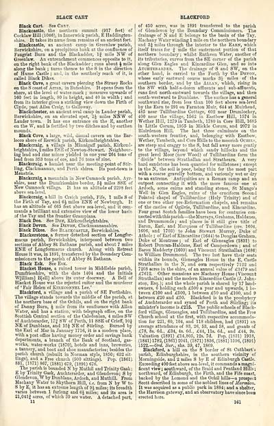
BLACK CART
Black Cart. See Cart.
Blackcastle, the northern summit (917 feet) of
Cocklaw Hill (1046), in Innerwick parish, E Haddington-
shire. It takes its name from remains of an ancient fort.
Blackcastle, an ancient camp in Greenlaw parish,
Berwickshire, on a precipitous bank at the confluence of
Faugrist Burn and the Blackadder, If mile NW of
Greenlaw. An entrenchment commences opposite to it,
on the right bank of the Blackadder ; runs about J mile
along the bank ; turns thence to the S in the direction
of Hume Castle ; and, in the southerly reach of it, is
called Black Dikes.
Black Cave, a great cavern piercing the Struey Rocks
on the S coast of Arran, in Buteshire. It opens from the
shore, at the level of water-mark ; measures upwards of
160 feet in length, SO in height, and 40 in width ; and
from its interior gives a striking view down the Firth of
Clyde, past Ailsa Craig, to Galloway.
Blackchester, an ancient oval camp in Lauder parish,
Berwickshire, on an elevated spot, 2J miles NNW of
Lauder town. It has one entrance on the E, another
on the W, and is fortified by two ditches and by earthen
mounds.
Black Cove, a large, wild, dismal cavern on the Bar-
locco shore of Kerwick parish, Kirkcudbrightshire.
Blackcraig, a village in Minnigaff parish, Kirkcud-
brightshire, 2 miles ESE of Newton-Stewart. Neighbour-
ing lead and zinc mines yielded in one year 264 tons of
lead from 353 tons of ore, and 76 tons of zinc.
Blackcraig, a hamlet near the meeting-point of Stir-
ling, Clackmannan, and Perth shires. Its post-town is
Menstrie.
Blackcraig- a mountain in New Cumnock parish, Ayr-
shire, near the Dumfriesshire border, 5J miles SSE of
New Cumnock village. It has an altitude of 2298 feet
above sea-level.
Blackcraig, a hill in Creich parish, Fife, 1 mile S of
the Firth of Tay, and 6£ miles ENE of Newburgk. It
has an altitude of 665 feet above sea-level, and it com-
mands a brilliant and extensive view of the lower basin
of the Tay and the frontier Grampians.
Black Dee. See Dee, Kirkcudbrightshire.
Black Devon. See Devon, Clackmannanshire.
Black Dikes. See Blackcastle, Berwickshire.
Blackerstone, a former detached section of Longfor-
macus parish, Berwickshire, interposed between two
sections of Abbey St Bathans parish, and about 7 miles
ENE of Longformacus church. Along with Retreat
House it was, in 1891, transferred by the Boundary Com-
missioners to the parish of Abbey St Bathans.
Black Esk. See Esk.
Blacket House, a ruined tower in Middlebie parish,
Dumfriesshire, with the date 1404 and the initials
W[illiam] B[ell] above its outer doorway. A Bell of
Blacket House was the rejected suitor and the murderer
of ' Fair Helen of Kirkconnel Lee.'
Blackford, a village and a parish of SE Perthshire.
The village stands towards the middle of the parish, at
the northern base of the Ochils, and on the right bank
of Danny Burn, £ mile from its confluence with Allan
Water, and has a station, with telegraph office, on the
Scottish Central section of the Caledonian, 4 miles SW
of Auchterarder, 17| SW of Perth, 11 SSE of Crieff, 10 J
NE of Dunblane, and 15J NE of Stirling. Burned by
the Earl of Mar in January 1716, it is a modern place,
with a post office having money order and savings bank
departments, a branch of the Bank of Scotland, gas-
works, water-works (1870), hotels and inns, breweries,
a tannery, and boot and shoe manufactories; besides the
parish church (rebuilt in Norman style, 1850; 632 sit-
tings), and a Free church (500 sittings). Pop. (1861)
881, (1871) 867, (1881) 679, (1891) 676.
The parish is bounded N by Muthil and Trinity Gask;
E by Trinity Gask, Auchterarder, and Glendevon; S by
Glendevon, W by Dunblane, Ardoch, and Mn thill. From
Machany Water to Sky thorn Hill, i.e. from N by W to.
S by E, it has an extreme length of 9J miles; its breadth
varies between 1 furlong and 6 J miles; and its area is.
21,041| acres, of which 39 are water. A detached part,
11
BLACKFORD
of 450 acres, was in 1891 transferred to the parish
of Glendevon by the Boundary Commissioners. The
drainage of N and E belongs to the basin of the Tay,
Machany Water winding 1 mile on the northern boundary
and 3J miles through the interior to the Earn, which
itself traces for f mile the easternmost portion of that
northern boundary ; whilst Ruthven Water, another of
its tributaries, curves from the SE corner of the parish
along Glen Eagles and Kincardine Glen, and so into
Atjohtekaiider. The drainage of S and SW, on the
other hand, is carried to the Forth by the Devon,
whose early eastward course marks 3J miles of the
southern border, and by the Allan, which, rising in
the SW with half-a-dozen affluents and sub-affluents,
runs first north-eastward towards the village, and then
south-westward to Dunblane. The surface has a general
southward rise, from less than 100 feet above sea-level
by the Earn to 291 on Farmton Muir, 644 at Muirhead,
485 near Tullibardine Cottage, 602 near Drumlochey,
400 near the village, 1562 in Eastbow Hill, 1574 in
Wether Hill, 1279 in Tambeth, 1780 in Core Hill, 1685
in Little Corum, 1955 in Mickle Corum, and 2072 in
Blairdenon Hill. The last three culminate on the
south-western frontier, and, belonging with Eastbow,
Wether, Tambeth, and Core Hills to the moorish Ochils,
are steep and craggy to the S, but fall away more gently
to the village, beyond which sandy hillocks and the
great level Moor (now Wood) of Tullibardine form the
' divide ' between Strathallan and Strathearn. A very
hard sandstone has been quarried for millstones ; except
in the N, the soil is poor, being thin for the most part
with a coarse gravelly bottom, and variously wet or dry
to an extreme. Antiquities are a Roman camp and an
outpost connecting it with the more famous one at
Ardoch, some cairns and standing stones, St Mungo's
Well in Glen Eagles, ruins of the cruciform Second
Pointed chapel of Tullibardine (Holy Trinity) and of
one or two other pre-Reformation chapels, and remains
of the castles of Ogilvie, Tullibardine, and Kincardine.
Four great Scotch families have been for centuries con-
nected with this parish — the Murrays, Grahams, Haldanes,
and Drummonds ; and places in it still give title of
Baron, Earl, and Marquess of Tullibardine (ere. 1604,
1606, and 1703) to John Stewart Murray, Duke of
Athole ; of Earl of Kincardine (1644) to Douglas Graham,
Duke of Montrose ; of Earl of Gleneagles (1831) to
Robert Duncan-Haldane, Earl of Camperdown ; and of
Baron Madderty (1609) and Viscount Strathallan (1686)
to William Drummond. The two last have their seats
within its bounds, Gleneagles House in the E, Castle
Strathallan in the N, and own respectively 7122 and
7208 acres in the shire, of an annual value of £3479 and
£7612. Other mansions are Machany House (Viscount
Strathallan) and the modern Kincardine Castle (J. John-
ston, Esq.); and the whole parish is shared by 17 land-
owners, 6 holding each £500 a year and upwards, 1 be-
tween £100 and £500, 1 between £50 and £100, and 9
between £20 and £50. Blackford is in the presbytery
of Auchterarder and synod of Perth and Stirling; its
minister's income is £215. The public schools of Black-
ford village, Gleneagles, and Tullibardine, and the Free
Church school at the first, with respective accommoda-
tion for 221, 60, 104, and 118 children, had (1891) an
average attendance of 83, 26, 53, and 58, and grants of
£78, 8s. 6d., £34, 4s. 6d., £44, lis. 6d., and £44, 9s.
Valuation (1891) £14,805, 12s. 7d. Pop. (1831) 1918,
(1841) 1782, (1861) 2041, (1871) 1836, (1881) 1596, (1891)
1522.— Ord. Sur., shs. 39, 47, 1869.
Blackford, a hill on the S border of St Cuthbert's
parish, Edinburghshire, in the southern vicinity of
Morningside, and 2 miles S by E of Edinburgh Castle.
Exceeding 400 feet above sea-level, it commands a magni-
ficent view ; southward, of the Braid and Pentland Hills ;
northward, of Edinburgh, the Firth, and the Fife coast,
backed by the Lomond and the Ochil hills — a prospect
Scott described in some of the noblest lines of Marmion.
It was acquired as a public park in 1884; and a shelter,
the Harrison gateway, and an observatory have since been
erected here.
161
Set display mode to: Large image | Transcription
Images and transcriptions on this page, including medium image downloads, may be used under the Creative Commons Attribution 4.0 International Licence unless otherwise stated. ![]()
| Gazetteers of Scotland, 1803-1901 > Ordnance gazetteer of Scotland > (169) Page 161 - BLA |
|---|
| Permanent URL | https://digital.nls.uk/97395274 |
|---|

