Ordnance gazetteer of Scotland > Volume 6
(22) Page 214
Download files
Complete book:
Individual page:
Thumbnail gallery: Grid view | List view

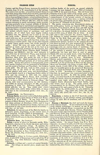
POLMOOD BURN
Carron ; and the Union Canal traverses the parish for
2| miles, from E to W, immediately S of the railway.
The coast is low and flat ; a broad tract inward thence is
carse land, rising only 14 feet above sea-level, protected on
the coast side by a strong embankment, and all too valu-
able to bear anything butgrain ; a tract southward thence,
forming the middle district, hasanundulatingsurface, and
rises to altitudes of 253 and 263 feet ; and the south-
western extremity is partly undulating, partly moorish,
and rises gradually to an eventual altitude of 552 feet.
Much of the landscape is embellished and beautiful ; and
many standpoints command extensive and brilliant views.
The rocks belong chiefly to the Carboniferous formation,
and include valuable strata of sandstone, coal, and
ironstone, all of which have been largely worked.
Excellent clay, too, abounds, and is used in two tile
and brick works. Mineral springs, strongly impreg-
nated with iron, are in several places. The soil of the
carse lands is deep fine clay, quite free from stones, but
abounding in marine shells ; that of the other districts
is partly clayey, partly mossy, but chiefly gravelly or
sandy. About 120 acres are under wood ; 650 are
pastoral or waste ; and all the rest of the land is in
tillage. The principal mansions are Westquarter, Pol-
mont Park, Polmont House, Polmont Bank, Parkhill,
Clarkston, and Millfield ; and the chief antiquity is
part of the line of Antoninus' Wall, now destitute of
every vestige of masonry or mound. The Duke of
Hamilton takes from this parish the title of Baron
Polmont (ere. 1643). Eight proprietors hold each an
annual value of £500 and upwards, 17 of between £100
and £500. Giving off a portion to Grangemouth quoad
sacra parish, Polmont is in the presbytery of Linlithgow
and the synod of Lothian and Tweeddale ; the living is
worth £427. The old kirk, built in 1731, stands, an
ivy-clad ruin, in the midst of the churchyard, its
interior planted with roses, yews, and rhododendrons.
The new parish church is a handsome Gothic edifice of
1844, and was adorned in 1876 with two stained
memorial windows. Robert Henry, D.D. (1718-90),
the historian of England, is buried in the churchyard.
There is also a Free church at Polmont village. Six
schools, with total accommodation for 861 children,
had (1884) an average attendance of 666, and grants
amounting to £552, lis. Valuation (1860) £14,501,
(1884) £27,781, lis. 6d. Pop. (1801) 2197, (1831)
3210, (1861) 4111, (1871) 3910, (1881) 3955, of whom
3861 were in the ecclesiastical parish. — Oral. Sur., sh.
31, 1867.
Polmood Burn. See Tweedsmuie.
Polnoon Castle, an ancient castle in Eaglesham parish,
Renfrewshire, near a head-stream of White Cart Water,
5 miles S by E of Busby. It was built with the
ransom of Harry Hotspur, whom Sir John Montgomerie
had taken prisoner at Otterburn (1388) ; and it long
was a chief seat of the Eglinton family ; but it is now
represented by only a few smooth mounds of rubbish. —
Ord. Sur., sh. 22, 1865.
Poltalloch, the ancient seat of the Malcolm family, in
Kilmartin parish, Argyllshire, on the eastern shore of
Loch Craignish, 10 miles NNW of Lochgilphead. Its
present proprietor, John Malcolm, Esq. (b. 1805 ; sue.
1857), holds 82,579 acres in the shire, valued at £18,200
per annum.
Poltanton Burn. See Leswalt.
Polton, a group of places in Lasswade parish, Edin-
burghshire, adjacent to the North Esk river, and within
\\ mile SSW of Lasswade village. It contains the
terminus of the Eskbank, Lasswade, and Polton line,
10J miles by rail SSE of Edinburgh ; the papermills
of Messrs Annandale & Son ; Polton Colliery ; Polton
House (Rt. Dundas, Esq. of Arniston), etc. — Ord. Sur.,
sh. 32, 1857.
Poltonhall, a village in Cockpen parish, Edinburgh-
shire, | mile SSW of Bonnyrigg, and li- mile S by W of
Lasswade. Pop. with Dalhousie Colliery (1871) 312,
(1881) 595.
Polwarth, a village and a parish of central Berwick-
shire. The village, an ancient place, stands near the
214
POMONA
northern border of the parish, on ground originally
swampy, but now drained, 3 miles NNE of Greenlaw,
and 4 SW of the post-town Duns. Two old thorn trees
formerly stood in the centre of the village green ; and a
custom prevailed for upwards of 300 years down to the
commencement of the present century, of dancing at
every marriage round these trees — a custom celebrated
in several songs, particularly one by Allan Ramsay, set
to the tune of ' Polwarth on the Green.'
The parish, containing also Marchmont station at
the south-eastern border, is bounded NW by Long-
formacus, N by Langton, SE by Fogo, and SW and W
by Greenlaw. Its utmost length, from E by N to W by
S, is 4^ miles ; its utmost breadth is 2J miles ; and its
area is 3013 acres, of which 13£ are water. A small
lake (If xl furl.) lies near the western border; and
the drainage is carried eastward towards Blackadder
Water by the Kirk Burn and other rivulets. The
surface, on the mutual border of the Merse and the
Lammermuir district, declines in the extreme E to 370
feet above sea-level, and rises westward till it attains a
maximum altitude of 933 feet at Eyles Hill. The pre-
dominant rocks are various kinds of sandstone ; but
Kyles Hill consists of a hard reddish porphyry. The soil
of the uplands is moorish, and elsewhere is mainly
argillaceous, but here and there is sand or gravel.
Nearly 400 acres are under wood ; rather less than half
of the entire area is in tillage ; and nearly all the
remainder is pasture, moor, or moss. Makchmont
House, noticed separately, is the only mansion ; and
Sir Hugh Hume-Campbell, Bart., is sole proprietor.
Polwarth is in the presbytery of Duns and the synod of
Merse and Teviotdale ; the living is worth £332. The
parish church, f mile SSE of the village, crowns the
edge of a beautiful glade in the gronnds of Marchmont,
and was rebuilt by Patrick Home, first Earl of March-
mont, in 1703. According to a Latin inscription of
that date, its predecessor was consecrated prior to 900,
and restored in 1378. In 1684 the patriot, Patrick
Home, concealed himself in the family burial vault be-
neath the church, where he remained for several weeks,
supplied every night with food by his celebrated
daughter Grizel, afterwards Lady Grizel Baillie, then
only twelve years of age. The public school, with
accommodation for 55 children, had (1884) an average
attendance of 35, and a grant of £34, 2s. 6d. Valuation
(1865) £2624, 2s., (1884) £2563, 3s., plus £1212 for 1\
miles of railway. Pop. (1801) 291, (1831) 288, (1861)
251, (1871) 249, (1881) 227.— Ord. Sur., shs. 25, 26,
1865-64.
Pomathoni, a station in the S of Lasswade parish,
Edinburghshire, on the Peebles railway, near Howgate
village, 2J miles NE of Leadburn, and 15 S of Edin-
burgh.
Pomona or Mainland, the chief and much the largest
of the Orkney islands. It lies southward of the centre
of the Orkney archipelago ; is washed, on the W and
the N, by the Atlantic Ocean ; is separated, on the NE,
by narrow sounds from Rousay, Gairsay, Shapinshay,
and some smaller adjacent islands, and by Westray Firth
and Stronsay Firth from the entire group of the North
Isles ; is washed, on the E, with exception of two or three
intervening islets, by the German Ocean ; and is separated,
on the S, by Holm Sound, Scapa Flow, and Hoy Sound
from Burray, South Ronaldshay, Flotta, Hoy, and some
smaller islands. Its utmost length, from E to W, is
24J miles ; its utmost breadth, from N to S, is 16J miles ;
and its area, in consequence of great and numerous in-
dentations on its outline, is probably not more than
150 square miles. Its western district, to the extent of
about 16 miles by 11, is fairly compact, and has a
somewhat ellipsoidal outline ; but its eastern district is
mostly cut by intersections of the sea into a series of
peninsulas and isthmuses, and ranges in breadth from a
maximum of 8$ miles to a minimum of 2 or 3 fur-
longs. Safe harbourage and pjlaces of anchorage occur
at brief intervals on all the north-eastern, the eastern,
and the southern coasts ; and are particularly good at
Kirkwall Bay, Deer Sound, Holm Sound, and Stromness.
Set display mode to: Large image | Transcription
Images and transcriptions on this page, including medium image downloads, may be used under the Creative Commons Attribution 4.0 International Licence unless otherwise stated. ![]()
| Gazetteers of Scotland, 1803-1901 > Ordnance gazetteer of Scotland > Volume 6 > (22) Page 214 |
|---|
| Permanent URL | https://digital.nls.uk/97387866 |
|---|
| Attribution and copyright: |
|
|---|---|

