Topographical dictionary of Scotland > Volume 2
(603) Page 595
Download files
Complete book:
Individual page:
Thumbnail gallery: Grid view | List view

W E E M
W E E M
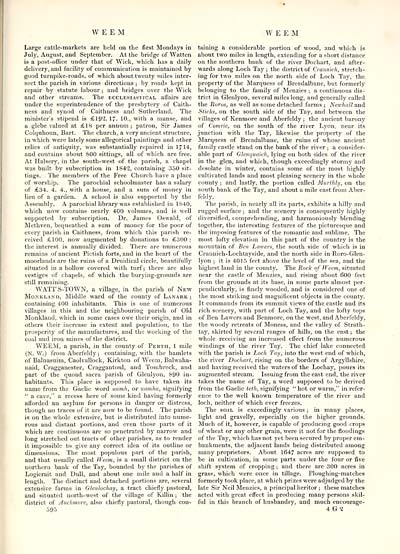
Large cattle-markets are held on the first Mondays in
July, August, and September. At the bridge of Watten
is a post-office under that of Wick, which has a daily
delivery, and facility of communication is maintained by
good turnpike-roads, of which about twenty miles inter-
sect the parish in various directions ; by roads kept in
repair by statute labour ; and bridges over the Wick
and other streams. The ecclesiastical affairs are
under the superintendence of the presbytery of Caith-
ness and synod of Caithness and Sutherland. The
minister's stipend is £192. 17- 10., with a manse, and
a glebe valued at £18 per annum; patron, Sir James
Colquhoun, Bart. The church, a very ancient structure,
in which were lately some allegorical paintings and other
relics of antiquity, was substantially repaired in 1714,
and contains about S00 sittings, all of which are free.
At Halsery, in the south-west of the parish, a chapel
was built by subscription in 1842, containing 350 sit-
tings. The members of the Free Church have a place
of worship. The parochial schoolmaster has a salary
of £34. 4. 4., with a house, and a sum of money in
lieu of a garden. A school is also supported by the
Assembly. A parochial library was established in 1S40,
which now contains nearly 400 volumes, and is well
supported by subscription. Dr. James Oswald, of
Methven, bequeathed a sum of money for the poor of
every parish in Caithness, from which this parish re-
ceived £100, now augmented by donations to £300 :
the interest is annually divided. There are numerous
remains of ancient Pictish forts, and in the heart of the
moorlands are the ruins of a Druidical circle, beautifully
situated in a hollow covered with turf; there are also
vestiges of chapels, of which the burying-grounds are
still remaining.
WATTS-TOWN, a village, in the parish of New
Monkland, Middle ward of the county of Lanark;
containing 400 inhabitants. This is one of numerous
villages in this and the neighbouring parish of Old
Monkland, which in some cases owe their origin, and in
others their increase in extent and population, to the
prosperity of the manufactures, and the working of the
coal and iron mines of the district.
WEEM, a parish, in the county of Perth, 1 mile
(N. W.) from Aberfeldy ; containing, with the hamlets
of Balnasuim, Caolvallock, Kirkton of Weem, Balwaha-
naid, Cragganester, Craggantonl, and Tombreck, and
part of the quoad sacra parish of Glenlyon, 890 in-
habitants. This place is supposed to have taken its
name from the Gaelic word uamh, or uamha, signifying
" a cave," a recess here of some kind having formerly
afforded an asylum for persons in danger or distress,
though no traces of it are now to be found. The parish
is on the whole extensive, but is distributed into nume-
rous and distant portions, and even those parts of it
which are continuous are so penetrated by narrow and
long stretched out tracts of other parishes, as to render
it impossible to give any correct idea of its outline or
dimensions. The most populous part of the parish,
and that usually called Weem, is a small district on the
northern bank of the Tay, bounded by the parishes of
Logierait and Dull, and about one mile and a half in
length. The distinct and detached portions are, several
extensive farms in Glenlochay, a tract chiefly pastoral,
and situated north-west of the village of Killin ; the
district of Auchmore, also chiefly pastoral, though con-
595
taining a considerable portion of wood, and which is
about two miles in length, extending for a short distance
on the southern bank of the river Dochart, and after-
wards along Loch Tay ; the district of Crannich, stretch-
ing for two miles on the north side of Loch Tay, the
property of the Marquess of Breadalbane, but formerly
belonging to the family of Menzies ; a continuous dis-
trict in Glenlyon, several miles long, and generally called
the Roros, as well as some detached farms ; Newhall and
Sticks, on the south side of the Tay, and between the
villages of Kenmore and Aberfeldy ; the ancient barony
of Comrie, on the south of the river Lyon, near its
junction with the Tay, likewise the property of the
Marquess of Breadalbane, the ruins of whose ancient
family castle stand on the bank of the river ; a consider-
able part of Glenquaich, lying on both sides of the river
in the glen, and which, though exceedingly stormy and
desolate in winter, contains some of the most highly
cultivated lands and most pleasing scenery in the whole
county ; and lastly, the portion called Murthly, on the
south bank of the Tay, and about a mile east from Aber-
feldy.
The parish, in nearly all its parts, exhibits a hilly and
rugged surface ; and the scenery is consequently highly
diversified, comprehending, and harmoniously blending
together, the interesting features of the picturesque and
the imposing features of the romantic and sublime. The
most lofty elevation in this part of the country is the
mountain of Ben Lawers, the south side of which is in
Crannich-Lochtayside, and the north side in Roro-Glen-
lyon ; it is 4015 feet above the level of the sea, and the
highest land in the county. The Rock of Weem, situated
near the castle of Menzies, and rising about 600 feet
from the grounds at its base, in some parts almost per-
pendicularly, is finely wooded, and is considered one of
the most striking and magnificent objects in the county.
It commands from its summit views of the castle and its
rich scenery, with part of Loch Tay, and the lofty tops
of Ben Lawers and Benmore, on the west, and Aberfeldy,
the woody retreats of Moness, and the valley of Strath-
tay, skirted b} r several ranges of hills, on the east ; the
whole receiving an increased effect from the numerous
windings of the river Tay. The chief lake connected
with the parish is Loch Tay, into the west end of which,
the river Dochart, rising on the borders of Argyllshire,
and having received the waters of the Lochay, pours its
augmented stream. Issuing from the east end, the river
takes the name of Tay, a word supposed to be derived
from the Gaelic teth, signifying " hot or warm," in refer-
ence to the well known temperature of the river and
loch, neither of which ever freezes.
The soil is exceedingly various ; in many places,
light and gravelly, especially on the higher grounds.
Much of it, however, is capable of producing good crops
of wheat or any other grain, were it not for the floodings
of the Tay, which has not yet been secured by proper em-
bankments, the adjacent lands being distributed among
many proprietors. About 1647 acres are supposed to
be in cultivation, in some parts under the four or five
shift system of cropping ; and there are 300 acres in
grass, which were once in tillage. Ploughing-matches
formerly took place, at which prizes were adjudged by the
late Sir Neil Menzies, a principal heritor ; these matches
acted with great effect in producing many persons skil-
ful in this branch of husbandry, and much encourage-
4 G<2
Set display mode to: Large image | Transcription
Images and transcriptions on this page, including medium image downloads, may be used under the Creative Commons Attribution 4.0 International Licence unless otherwise stated. ![]()
| Gazetteers of Scotland, 1803-1901 > Topographical dictionary of Scotland > Volume 2 > (603) Page 595 |
|---|
| Permanent URL | https://digital.nls.uk/97368366 |
|---|
| Description | Volume II: From Keanlochbervie to Zetland. |
|---|---|
| Attribution and copyright: |
|

