Gazetteer of Scotland
(196) Page 186 - FOR
Download files
Complete book:
Individual page:
Thumbnail gallery: Grid view | List view

FOR
186
FOS
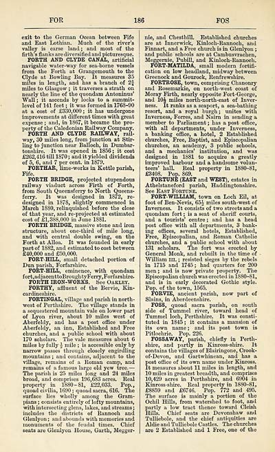
exit to the German Ocean between Fife
and East Lothian. Much of the river's
valley is carse land ; and most of the
firth's flanks are diversified and picturesque. ]
FORTH AND CLYDE CANAL, artificial |
navigable water-way for sea-borne vessels
from the Forth at Grangemouth to the
Clyde at Bowling Bay. It measures 35
miles in length, and has a branch of 2f
miles to Glasgow ; it traverses a strath on
nearly the line of the quondam Antoninus'
"Wall j it ascends by locks to a summit-
level of 141 feet ; it was formed in 1768-90
at a cost of £330,000; it has undergone
improvements at different times with great
expense ; and, in 1867, it became the pro-
perty of the Caledonian Railway Company.
FORTH AND CLYDE RADLWAY, rail-
way, 30 miles long, from junction at Stir-
ling to junction near Balloch, in Dumbar-
tonshire. It was opened in 1856 ; it cost
£262,416 till 1870 ; and it yielded dividends
of 5, 6, and 7 per cent, in 1879.
FORTHAR, lime-works in Kettle parish,
Fife.
FORTH BRIDGE, projected stupendous
railway viaduct across Firth of Forth,
from South Queensferry to North Queens-
ferry. It was designed in 1872, re-
designed in 1878, slightly commenced in
March 1880, relinquished before the close
of that year, and re-projected at estimated
cost of £1,388,000 in June 1881.
FORTH BRIDGE, massive stone and iron
structure, about one-third of mile long,
and with central double swing, on the
Forth at Alloa. It was founded in early
part of 1882, and estimated to cost between
£40,000 and £50,000.
FORT-HILL, small detached portion of
Dun parish, Forfarshire.
FORT-HILL, eminence, with quondam
fort,adjacenttoBroughtyFerry,Forfarshire.
FORTH IRON-WORKS. See Oaklet.
FORTHY, affluent of the Bervie, Kin-
cardineshire.
FORTINGAL, village and parish in north-
west of Perthshire. The village stands in
a sequestered mountain vale on lower part
of Lyon river, about 10 miles west of
Aberfeldy, and has a post office under
Aberfeldy, an inn, Established and Free
churches, and a public school with about
170 scholars. The vale measures about 6
miles by fully J mile ; is accessible only by
narrow passes through closely engirdling
mountains ; and contains, adjacent to the
village, remains of a Roman camp, and
remains of a famous large old yew tree. —
The parish is 25 miles long and 24 miles
broad, and comprises 196,683 acres. Real
property in 1880-81, £22,033. Pop.,
quoad civilia, 1690 ; quoad sacra, 616. The
surface lies wholly among the Gram-
pians ; consists entirely of lofty mountains,
with intersecting glens, lakes, and streams ;
includes the districts of Rannoch and
Glenlyon ; and abounds with memories and
monuments of the feudal times. Chief
seats are Glenlyon House, Garth, Megger-
nie, and ChesthilL Established churches
are at Innerwick, Kinloch-Rannoch, and
Finnart, and a Free church is in Glenlyon ;
and public schools are at Cambusvrachen,
Meggernie, Pubill, and Kinloch-Rannoch.
FORT-MATILDA, small modern fortifi-
cation on low headland, midway between
Greenock and Gourock, Renfrewshire.
FORTROSE, town, comprising Chanonry
and Rosemarkie, on north-west coast of
Moray Firth, nearly opposite Fort-George,
and 10^ miles north-north-east of Inver-
ness. It ranks as a seaport, a sea-bathing
resort, and a royal burgh; unites with
Inverness, Forres, and Nairn in sending a
member to Parliament ; has a post office,
with all departments, under Inverness,
a banking office, a hotel, 2 Established
churches, Free, Baptist, and Episcopalian
churches, an academy, 3 public schools,
and a mechanics' institution, and was
designed in 1881 to acquire a greatly
improved harbour and a handsome volun-
teers' hall. Real property in 1880-81,
£3408. Pop. 869.
FORTUNE (EAST and WEST), estates in
Athelstaneford parish, Haddingtonshire.
See East Fortune.
FORT- WILLIAM, town on Loch Eil, at
foot of Ben-Nevis, 65J miles south-west of
Inverness. It consists of two streets and a
quondam fort ; is a seat of sheriff courts,
and a tourists' centre ; and has a head
post office with all departments, 3 bank-
ing offices, several hotels, Established,
Free, Episcopalian, and Roman Catholic
churches, and a public school with about
131 scholars. The fort was erected by
General Monk, and rebuilt in the time of
William in. ; resisted sieges by the rebels
in 1715 and 1745; had quarters for 200
men ; and is now private property. The
Episcopalian church was erected in 1880-81,
and is in early decorated Gothic style.
Pop. of the town, 1565.
FORVTE, ancient parish, now part of
Slains, in Aberdeenshire.
FOSS, quoad sacra parish, on south
side of Tummel river, toward head of
Tummel loch, Perthshire. It was consti-
tuted in 1845 ; it contains a mansion of
its own name ; and its post town is
Pitlochrie. Pop. 226.
FOSSAWAY, parish, chiefly in Perth-
shire, and partly in Kinross-shire. It
contains the villages of Blairingone, Crook-
of -Devon, and Gartwhinean, and has a
post office of its own name under Kinross.
It measures about 11 miles in length, and
10 miles in greatest breadth, and comprises
10,429 acres in Perthshire, and 6904 in
Kinross-shire. Real property in 1880-81,
£8859 and £6746. Pop. 772 and 495.
The surface is mainly a portion of the
Ochil Hills, from watershed to foot, and
partly a low tract thence toward Cleish
Hills. Chief seats are Devonshaw and
Tulliebole, and the chief antiquities are
Aldie and Tulliebole Castles. The churches
are 2 Established and 1 Free, one of the
Set display mode to: Large image | Transcription
Images and transcriptions on this page, including medium image downloads, may be used under the Creative Commons Attribution 4.0 International Licence unless otherwise stated. ![]()
| Gazetteers of Scotland, 1803-1901 > Gazetteer of Scotland > (196) Page 186 - FOR |
|---|
| Permanent URL | https://digital.nls.uk/97357573 |
|---|

